
OSINT Jet · Reading aerial evidence
Satellite image resolution: is the picture detailed enough for your claim?
A pale rectangle appears beside a field. Someone calls it a warehouse and points to a tiny dark mark as its entrance. Before debating the building, ask a simpler question: how much ground does one image pixel represent?
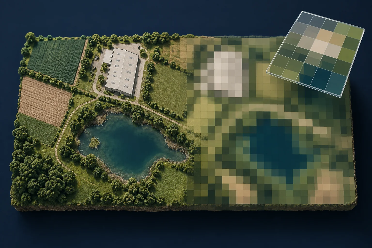
For a basic visual OSINT check, compare the feature’s size with the image’s ground sampling distance, then inspect the actual conditions. This tells you when an image may help and when you should seek a different source. It is a suitability check, not an object-recognition formula.
Screen size is not ground detail
A pixel is a cell in the image grid. Ground sampling distance, often shortened to GSD, describes the spacing of those samples on the ground. For a square 10-metre grid, one cell represents roughly a 10-by-10-metre patch. Optical sharpness, contrast, processing and scene conditions also affect what can be distinguished. The grid spacing alone does not guarantee that every object of that width is recognizable.
NASA’s satellite-image interpretation guide puts scale, patterns and context at the start of reading an image. A screenshot’s dimensions tell you its display size, not the ground sampling of the source. A 2,000-pixel-wide screenshot may simply enlarge a small area of a coarser image.
Read the product and band, not just the satellite name
Sentinel-2 is a useful example. Its bands have different native spatial resolutions. B2, B3, B4 and B8 are 10-metre bands; six other bands are 20 metres, and three are 60 metres. A true-colour view commonly uses B4, B3 and B2. Check the actual selection rather than assigning “10 metres” to every Sentinel-2 layer. Copernicus lists the bands and their resolutions.
Also distinguish a source band from an exported grid. A product or viewer can resample a layer into a different pixel spacing. Copernicus describes the available grids in its Sentinel-2 product documentation. A finer output grid is not proof that the original sensor made finer observations. Record both the source resolution and the export setting when you can establish them.
The width test: useful arithmetic with a strict limit
As a rough screening calculation, divide the feature’s width by the ground sample spacing. Do the same for its length. The result estimates how many grid cells span it; it does not predict recognition accuracy. Orientation and alignment matter, and a feature’s edges may cross mixed cells.
Invented teaching example: imagine a roof measuring 60 by 30 metres, a 3-metre-wide access lane and a 2-metre-wide doorway. Assume the dimensions are known independently, the grid is 10 metres and the view is approximately overhead.
| Feature | Approximate grid span | Reasonable next question |
|---|---|---|
| 60 × 30 m roof | 6 × 3 cells | Is there a broad roof-like patch in the expected position, with enough contrast to compare? |
| 3 m lane width | 0.3 of a cell | Could a thin contrasting line affect the image without its width being measurable? |
| 2 m doorway width | 0.2 of a cell | Does this image contain any defensible basis for identifying that particular doorway? |
The roof spans enough nominal cells to make a broad shape comparison worth attempting. That does not establish its use, owner or opening date. The doorway claim is not supported by this sampling calculation. Enlarging the image until a dark block resembles a door would not supply the missing observation.
A feature smaller than a cell can still affect its brightness or colour, especially when contrast is strong. Do not turn the width test into “anything below one pixel is invisible.” The important distinction is between noticing a signal and identifying or measuring the object that caused it.
Four reasons a promising image can still be unsuitable
- Mixed pixels: a cell at a roof edge can include roof, ground and shadow. Treat its colour as a combined signal, not a pure sample of one material.
- Cloud and shadow: the place you need may be obscured even when most of the scene is clear. Inspect the target area, not just a scene-wide cloud percentage.
- Colour mapping: a false-colour composite assigns bands to display colours. A red patch is not automatically a red object. Note the layer and band combination.
- Time and processing: a mosaic may combine acquisitions, and a sharpened export may differ from the source. Establish which dated observation your sentence actually refers to.
These checks are reasons to narrow a conclusion, not reasons to discard all coarse imagery. A broad land-cover question can be well matched to a dataset that is unsuitable for reading a sign.
Use a claim-to-image note
Question to answer:
Smallest feature needed to answer it:
Source / product / band or composite:
Acquisition date or date range:
Native sample spacing, if known:
Export spacing and any enhancement:
Approximate feature width in cells:
Cloud, shadow, mixed-edge or contrast limits:
Supported observation:
What requires another source:
For the fictional roof, an appropriate note might say: “The image shows a light rectangular patch broadly consistent with the supplied footprint. The access arrangement and building use are unresolved at this level of detail.” A site plan or dated ground-level image could address those questions. Neither would automatically prove ownership; that needs records relevant to the entity.
If your problem is finding the location, use the image geolocation guide. If you already know the location and need an earlier street-level view, follow the Street View history workflow. Keep those tasks separate from deciding whether this image has enough detail.
Can sharpening or AI enhancement settle the question?
Enhancement can make a picture easier to inspect. It may also introduce estimated edges or texture. Preserve the original, record the method and label the derived version. Do not treat a newly crisp doorway, digit or boundary as independently observed evidence unless it is supported by suitable source data. This guide does not assess specialist multi-image reconstruction methods.
Where the remaining work is connecting visible clues to a wider case, OSINT Jet’s image investigation workflow provides a route for visual analysis with context. Supply the source, date, resolution limits and precise question. An analysis tool cannot turn an unsuitable image into direct evidence of details the source does not resolve.
Discuss the scope of a complex image case
Published 10 October 2026 · OSINT Jet